A significant proportion of the UK and Ireland’s utility, building and transport infrastructure is buried underground, including around 4Mkm of pipes, electricity and telecoms cables, and sewers.

David Sayad is head of department – subsurface engineering at Murphy Geospatial
This dense web of subsurface infrastructure is constantly changing too, the National Underground Asset Register (NUAR) in the UK estimates a hole is dug in the ground every seven seconds to access these pipes and cables for repairs, upgrades and installations. Hundreds of years’ worth of investment in utilities can be found underground, with the first pipes buried in the early 1800s.
Several centuries later, it’s not surprising that developers find navigating this valuable and complex unseen existing infrastructure difficult and landowners are frequently perplexed by what lies beneath their assets.
The potential economic cost and health and safety risks of trying to understand mystery infrastructure is serious business. The Utility Strike Avoidance Group estimates the UK faces an estimated 60,000 accidental strikes of utility infrastructure annually, leading to injury, project delays and disruption to traffic and local economies. The total direct and indirect yearly costs of these accidental strikes are predicted to be £2.4bn in the UK alone.
Harnessing technology for informed decision-making
Technology has transformed what surveyors can tell clients about the unseen environment below street level, sometimes without disruption to the site itself. Multiple options exist for those who want to understand more about mystery underground infrastructure, these include:
- Underground utility surveys are used to identify and verify the location and depth of buried services, features, materials, and voids
- Ground Penetrating Radar (GPR) offers non-invasive detection of buried objects, utilities, and structures in the subsurface, providing valuable information for archaeological studies, construction projects, and environmental assessments
- CCTV drainage surveys provide detailed visual information about the condition of underground pipes, sewers, and utilities without the need for costly excavation or disruption
- Building Information Modelling (BIM) allows visualisation, clash detection and coordination of better project planning
Surveyors with the skills to use these technology types can now provide developers with geospatial data which gives them the ability to make informed decisions when planning, designing and constructing anything that requires them to navigate the complex subsurface environment.
Case study: Minerva House – Mystery Utility Identification, London, England
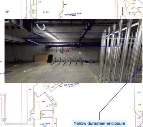
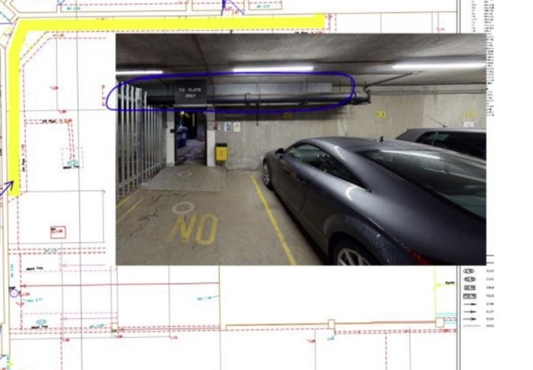
Minerva Ave, London, required detailed information about a mystery set of cables within a building basement covered by steel casing to proceed with a developer’s proposed design.
Specialist surveyor Murphy Geospatial was engaged to investigate and identify this unknown infrastructure.
By obtaining records from various asset owners and conducting a comprehensive utility survey, we determined that the cables belonged to British Telecoms (BT) but were not recorded accurately on the asset records. This crucial information allowed the developer and project team to progress confidently with their design and build works, avoiding the costs and disruptions associated with further invasive exploratory work.
To understand more about the subsurface below your project, find out more about Murphy Geospatial’s subsurface survey solutions here: https://murphygs.com/services/subsurface-surveys/
- David Sayad is head of department – subsurface engineering at Murphy Geospatial
Like what you've read? To receive New Civil Engineer's daily and weekly newsletters click here.


Have your say
or a new account to join the discussion.